Friday 31 March 2017

Siberian William Tell

By ERIC A. POWELL
Monday, February 13, 2017
Trenches Siberia Quiver
(Courtesy Nikita Konstantinov)
Bark quiver


In the Siberian Altai
 region, two local residents recently discovered the burial of a medieval man in a cliff-face crevice. They reported the find to local museum officials and turned over a number of artifacts interred with the man, including an intricately decorated birch-bark quiver and iron-tipped arrows, which are now being studied and conserved by a team led by archaeologist Nikita Konstantinov of Gorno-Altaisk State University. Konstantinov believes that the archer lived sometime between the thirteenth and fifteenth centuries, a period when the Mongolian Empire’s Golden Horde ruled the area. “Here in the Altai we have very few sites dating to this era,” says Konstantinov. “This burial is well preserved, so it should help us to better understand the Mongolian period.” His team will fully investigate the site during the upcoming field season.

Archaeologists believe they have found ancient Silk Road capital

Wall ruins believed to belong to ancient capital of Loulan found in NW China
News.cgtn.com
By Jin Zixiong  30 March 2017 
Ruins of ancient city walls have been found in northwest China's Lop Nur Desert, the site of the former capital of Loulan, a prosperous settlement built around 2,000 years ago to serve passing traders traveling along the Silk Road.
Loulan, which is often called the Oriental Pompeii, was an important stop on the ancient trade route linking China and Central Asia. Now situated in present-day Xinjiang Uygur Autonomous Region, it thrived based around an oasis in a section of the desert so arid and remote that it was known as "no man's land."
The archaeological institute of Xinjiang Uygur Autonomous Region said excavations had unearthed a circular wall, with a diameter of 300 meters. The base of the wall is 2.2-2.7 meters wide. The highest remaining part is 2.5 meters tall.
Hu Xingjun, a research fellow with the institute, said red willow branches and reeds found among the ruins had been carbon dated, and the results suggested the structure dates back to the late period of the Eastern Han Dynasty (25-220AD).
The archaeologists believe the city was one of the capitals established by the Kingdom of Loulan, which was moved several times due to water resources, natural disasters, widespread disease and war. It had disappeared completely by the Tang Dynasty (618-907).
Few traces remain of Loulan, an important stop on the ancient trade route linking China and Central Asia / CFP Photo
The mysterious city was rediscovered first by Swedish adventurer Sven Hedin in 1900. The wall ruins that he found were square in shape.
Hu said the circular ruins were about 57 kilometers away from those found by Hedin. The new discovery might be one of the capitals of Loulan, while the earlier finding could be a newer location of the ancient kingdom, which was renamed Shanshan, and administrated by the Han Dynasty.
Along with the wall ruins, archaeologists also discovered a number of items in seven adjacent tombs, including wooden plates, a copper mirror, a wooden comb and textiles.
Since the 20th century, archaeologists from around the world have found a great number of well-preserved bodies and antiques around Loulan, with the Tarim mummies one of the most significant finds. DNA tests on the mummified bodies, which date back as early as 1800 BCE, have suggested they may have originally had Caucasian ancestry.
The central government has allocated millions of yuan to excavation projects in Loulan. Items ranging from Han Dynasty coins, utensils and fabrics in Greek and Roman styles have been unearthed from previous Loulan digs.
(Source: Xinhua)


Archaeologists in China believe they have found ancient Silk Road capital

Experts believe city was the capital of the Loulan Kingdom


Archaeologists in Xinjiang believe an ancient city and three tombs they unearthed in the Lop Nor area of a desert was the capital of the Loulan Kingdom along the ancient Silk Road.
The ancient city, uncovered in January along the north bank of the Kongque River, sat in the depths of the desert, 57.5km to the west of an ancient city of the Loulan Kingdom that Swedish explorer Sven Hedin discovered in 1900, China National Radio reported.
Archaeologists spent two months reconstructing the site, which was built on a loess platform, and restored the city, of which only sections of walls remained due to wind erosion. The city was a circle of 300 metres in diameter with walls of 2.2 to 2.7 metres high.

Bronze weapons, coins, a millstone and bow and arrows were unearthed in the city.
The archaeologists concluded that the city matched tales of the capital city of the Loulan Kingdom by its geographic location, architectural style and articles found in the tombs.
They believed the city Hedin discovered was the capital city of the kingdom after it was renamed Shanshan and relocated its capital after 77BC.

Monday 27 March 2017

Silk Road Forum


page2image400


April 2, 2017, Sunday 1:30-5:00 pm
Princeton University McCormick Hall Room 101

1:30-3:00
The Silk Roads: Leading Us Astray?
Susan Whitfield, IDP, The British Library Response by Xin YU, Fudan University
Is the Silk Road a meaningful or misleading concept for our understanding of pre-modern Afro- Eurasia? How has its emergence as a worldwide brand and, most recently, as a politico- economic strategy, threatened or assisted scholarship? Should we reject or embrace it? Susan Whitfield will consider these questions, looking at the origin, history and growth of the Silk Road concept and its modern manifestations.


3:30-5:00
The Ancient Silk Road in Light of New Discoveries in Gansu
Doucheng DU, Lanzhou University
Response by Annette Juliano, Rutgers University

The overland Silk Road may have been opened in ancient times, the maritime route may have developed long before the Song dynasty, and political and military interests may have been stronger than economic ones. This talk introduces recent discoveries in Buddhist archaeology in Gansu province against this historical background.


5:00-6:30. Reception 


Huaiyu CHEN is Associate Professor at Arizona State University, where he teaches Chinese religion, Buddhism, and Silk Road Studies. His books cover Chinese Buddhist monasticism, the philosophy of animals in Buddhism, and modern Chinese Buddhist historiography.
Doucheng DU, a Gansu native, graduated from Peking University and is Professor at Lanzhou University, where he has served as Chair of the Department of History and Director of the Institute for Dunhuang Studies. He has published ten books and authored more than sixty articles on Dunhuang studies and related subjects.
Annette Juliano is Professor of Art History at Rutgers University-Campus at Newark, where she teaches Far Eastern art history. She chaired the new Department of Visual and Performing Arts and also served as Associate Dean. She is Visiting Research Scholar at the Institute for the Study of the Ancient World at New York University.
Stephen F. Teiser is D.T. Suzuki Professor in Buddhist Studies at Princeton University. He works on the history of Buddhism, Chinese religion, and the Silk Road. His books utilize textual and artistic sources to discuss healing, death, and rebirth.
Susan Whitfield is a historian of China and the Silk Road. As Director of the International Dunhuang Project at the British Library, she curates a large collection of Central Asian manuscripts and works with colleagues worldwide to make this and the rest of the archaeological legacy from the eastern Silk Road freely available online. She has written widely on the Silk Road, and has travelled along much of its length.
Xin YU is Professor of History at Fudan University and has held visiting appointments at Ecole des Haute Etudes en Sciences Sociales and Princeton University. He has written four monographs on topics ranging from popular Chinese religion to natural history and manuscript studies.

https://csr.princeton.edu/silkroadforum/ 

The Mongols and the Islamic World: From Conquest to Conversion

The Mongols and the Islamic World: From Conquest to Conversion 

Hardcover – 4 Apr 2017


Friday 24 March 2017

Wisdom of the Mountains


Wisdom of the mountains from Van Osch Films on Vimeo.

The Pamiri people of Afghanistan and Tajikistan are among the most isolated communities in the world. They live according to centuries-old traditions. Slowly but surely Western influences enter this remote mountain region.
In this documentary film we travel through the Pamir Mountains with Frederik van Oudenhoven. He is the author of ‘With our own hands’, a book about the traditional dishes and the food and farming culture of the Pamiri people. It is the first written source about their culture that is accessible in their own language. Frederik brings his book back to its source. He speaks with farmers about the struggles they are facing: can the Pamiri people stay true to their old traditions while adapting to a new world?

11 April 2017: Frederik van Oudenhoven presents the documentary film Wisdom of the Mountains in Leiden University

Time
17.00-18.30 hrs 

Venue Lipsius Building
Room 147
Leiden 


Followed by drinks! All welcome!

Wisdom of the Mountains 

The Pamir people in Tajikistan and Afghanistan are among the most isolated communities in the world. They live according to century old traditions. Yet slowly but surely the Western world enters this remote mountain area.
In the documentary film Wisdom of the Mountains the crew travels through the Pamir Mountains together with Frederik van Oudenhoven. He is the author of ‘With our own hands’, a book about traditional dishes and the food and farming culture of the Pamiri people. He brings his book back to its source. Frederik speaks with farmers about the changes they are facing: Are they staying true to their old traditions or will they – slowly but surely – adopt the Western influences.

Trailer Wisdom of the Mountains

With Our Own Hands. A Celebration of Food and Life in the Pamir Mountains of Afghanistan and Tajikistan

About the book 
In the autumn of 2009, a grandmother in the village of Mun, in the Ghund valley of the Tajik Pamir Mountains, approached two young researchers and asked them to write down her old recipes. “I want to share them with my children and grandchildren while I still remember what I know,” she said.

Surrounded by her family and neighbours, the conversations about the recipes became a passage into the timeworn traditions of the Pamir Mountains and the rapid changes they now face. Over the following years, her voice was joined by those of many other grandmothers and grandfathers, children, teachers and farmers. Together they are this book: a unique and intimate portrait of the Pamir Mountains of Afghanistan and Tajikistan.

"This...may be one of the most beautiful books I have ever read..!" Frénk van der Linden. Listen to the interview with Frederik van Oudenhoven (in Dutch) on Radio 1 from 19 August 2015.

About the authors 
Frederik and Jamila first met over a bowl of apricot soup in the village of Darmorakht in the Tajik Pamirs. Frederik was introduced to the Pamirs through his research on agricultural biodiversity conservation at Bioversity International in Rome. Jamila was working with the Aga Khan Foundation’s rural development programme.

Frederik is an ethnobiologist who works with smallholder farmers and indigenous communities around the defence of traditional food and agricultural practices. Jamila studies the relationship between poverty and agricultural biodiversity as a PhD candidate at the Stockholm Resilience Centre.

The photographs in this book were taken by three award-winning photographers: Judith Quax, Theodore Kaye and Matthieu Paley. René Put was the graphic designer.

One book, three languages 
Besides English, the languages in this book are Dari and Tajik. They are the forms of Persian spoken in Afghanistan and Tajikistan respectively. The languages are not as different as their distinctive scripts suggest: Dari and Tajik speakers can understand each other well, yet their different histories have meant that the former is written in the Arabic script, while the latter is in a slightly modified version of Cyrillic.
Most people in the Pamirs speak Dari or Tajik only as their second (or third) language, their mother tongue being one of a number of unwritten Pamiri languages, unrelated to Persian. Partly as a result of these influences, Dari and Tajik are spoken very differently in the countryside of the Pamirs from how they are spoken in the capitals of the two countries, Kabul and Dushanbe. In the translations, we have sought to find a balance between these different ways of speaking the languages which, while comprehensible to all, does not oversimplify the language or take away from its beauty.
The choice to make a book in which the three languages are combined was inspired by the authors' wish to return a copy to each community, school and library in the Pamirs. It is also intended to give expression to the close historical ties between the people on either side of the Afghan–Tajik border, and between them and the people from around the world who will read this book in English. 

Wednesday 22 March 2017

Ancient Tomb Decorated with Vibrant Murals Found in China

Ancient Tomb Decorated with Vibrant Murals Found in China
The tomb's entranceway is located on the south wall of the tomb. It was blocked off with bricks 1,000 years ago. Images of two servants can be seen flanking the entrance. 
Credit: Courtesy of Chinese Cultural Relics
A 1,000-year-old circular tomb, whose walls are decorated with colorful murals, has been discovered in Datong City, in northern China.
Because the tomb's entranceway is sealed off with bricks, archaeologists had to enter through a hole in the deteriorating arch-shaped roof.
The team, from the Datong Municipal Institute of Archaeology, found cremated human remains in an urn in the middle of the tomb. No texts were found in the tomb, but the archaeologists believe that the tomb likely belonged to a husband and wife. [See Photos of the Circular Tomb and Colorful Murals]
Colorful clothing abounds on the tomb's murals. One clothes stand, painted on a mural on the west wall, has "sky blue, beige, bluish-gray, yellowish-brown and pink clothes," wrote the archaeological team in a paper published recently in the journal Chinese Cultural Relics. "The garment to the far right has a green-diamond grid pattern, each diamond of which has a small red decorative flower in it," wrote the archaeologists, noting that another article of clothing has what appears to be a jade ring that "hangs at the waist."

The murals on the west wall of the 1,000-year-old tomb depict articles of clothing as well as two servants.
Credit: Courtesy of Chinese Cultural Relics 
Additionally, the mural shows that "in front of the clothes stand there is a long rectangular table, on which are placed four round plates, black on the outside and red inside, holding, respectively, a headdress, bracelets, hairpins and combs," the archaeologists wrote.

On the east wall of the tomb the mural shows another clothes stand. "On the stand hang beige, light green, bluish-gray, pink and brown clothes," the archaeologists wrote. "On one of the garments hangs a ring-shaped pei pendant accompanied by a string of black beads." Pei is a word that can mean "matching" or "accompanying" in English.
The team believes that the tomb likely dates to the Liao Dynasty (A.D. 907–1125). Historical records indicate that this dynasty, controlled by the Khitan, flourished in northern China, Mongolia and parts of Russia.
At that time, people in northern China were sometimes buried in tombs decorated with murals. In 2014, Live Science reportedon the discovery of another tomb containing murals, which was found decorated with images of stars as well as numerous animals, including a crane, deer, yellow turtle and even a cat playingwith a silk ball. That tomb was also excavated by a team from the Datong Municipal Institute of Archaeology.
Archaeologists believe that both mural-decorated tombs will help shed light on  those who lived during the Liao Dynasty. 
The tomb with the murals showing colorful clothing was excavated by the Datong Municipal Institute of Archaeology team in 2007. The team published a report on the tomb in 2015, in Chinese, in the journal Wenwu. That report was translated into English for publication in Chinese Cultural Relics.
Original article on Live Science.

Exploring the Silk Road: Slave Trade at Turfan

The world’s most famous trade route did not only witness the transfer of silks, spice, and various other commodities, but also humans. Who were the slaves traded along the ancient route? Who were the traders? Where did they come from? Professor Jonathan Skaff from Shippensburg University of Pennsylvania offered answers during a lecture about Silk Road Slave Trade at Turfan during the Tang Dynasty on October 17th. The event was sponsored by NYU Shanghai’s Center for Global Asia.
As he led his NYU Shanghai audience to rediscover the Silk Road from a new angle, Prof. Skaff digged through the history of the Eurasian slave trade between West and East Asia during the 7th and 9th centuries CE. He focused his analysis on the Turfan oasis in the Central Asian Turfan Basin and argued that its arid climate and irrigated agriculture contributed to the trade.
“Central Asian merchants and the elite class in Tang Dynasty were found buying, selling and traveling with human chattels,” asserted Prof. Skaff.
Purchase contracts of slaves written on paper have come to light in several tombs in the Turfan region. Recycled as hats and shoes, the documents were buried along with the corpses and other grave goods. The standard information recorded in such  contracts comprised the gender and places of origins of the slaves as well as the names  of their sellers and buyers.
In his talk, Prof. Skaff introduced the results of his analysis of the contracts. One of his conclusions was, for example, that Sogdians were most active in the slave trade. He also showed that 80 percent of the caravans dealt with slaves, who accounted for up to 38.5 percent of all travellers.  
“The Tang Empire exerted enormous influence on the economics of slave trade. The legal, military, administrative and transportation systems of the Tang Empire facilitated human trafficking by guaranteeing road transportation and enforcing the contracts,” Skaff said, adding that there was no age limit for slaves and most of them were kids from poor families.
The talk was hosted by Interim Director for the Center for Global Asia, Assistant Professor Armin Selbitschka. It was the latest installment in a regular lecture series that is sponsored by the Center of Global Asia and has featured a number of distinguished scholars including Wang Gungwu, Amitav Ghosh, and Prasenjit Duara in the past.


Tuesday 21 March 2017

2,000 year old warrior armour made of reindeer antlers found on the Arctic Circle

By The Siberian Times reporter
16 March 2017
Ceremonial suit was embellished with decorations and left as a sacrifice for the gods by ancient bear cult polar people, say archeologists.
'The ornamentation on the plates can be individual, that is after the through analysis we could say how many warriors left armour here.' Picture: Andrey Gusev 
The discovery is the oldest evidence of armour found in the north of western Siberia, and was located at the rich Ust-Polui site, dating to between the 1st century BC and the 1st century AD.
Earlier discoveries at the site indicate a bear cult among these ancient people. 
Archeologist Andrey Gusev, from the Scientific Research Centre of the Arctic in Salekhard, said the plates of armour found at the site are all made from reindeer antlers. 
Armor plateArmor plate

Armor plate
'The largest were 23-25 centimetres in length (pictured upper left). Others are 12-14 centimetres in length, thinner and richly ornamented (pictured upper right and bottom).' Pictures: Andrey Gusev 
'There are about 30 plates in the collection of Ust-Polui,' he said. 'They differ regarding the degree of preservation,  as well as the size, location of mounting holes, and the presence or absence of ornamentation.'
The largest were 23-25 centimetres in length. In ancient times, they would have been fixed to a leather base and offered a reliable means of protection.
Others are 12-14 centimetres in length, thinner and richly ornamented. 
Armor plates

Armor plates

Armor plates
'I'm writing still under the impression, as I've just seen these things. This is literally a world scale discovery'. Picture: Bear ring, bronze, finding of 2013, by Andrey Gusev 
'The ornamentation on the plates can be individual, that is after the through analysis we could say how many warriors left armour here, judging by the style of decorations.'  
Other conical shaped armour is seen as plates on helmets worn by the ancient warriors. 'In the taiga zone of Western Siberia, finds of real iron helmets were extremely rare,' he said. 'But in the middle of the first millennium AD, bronze images appeared of people wearing headdresses clearly resembling helmets.
'A likely explanation may be a long tradition of making antler helmets.' 
Kulai armor
According to Gusev Yamal armor resembled the design used by Kulai peole. Picture: Alexander Soloviev
Gusev said the armour resembled the warrior picture here, which relates to designs used by the Kualai people, hunters and fishermen native to the taiga.
He believes the armour was deliberately left at Ust-Polui, an ancient sacred place, as a gift or sacrifice to the gods.
As previously revealed by The Siberian Times, a 2,000 year old ring found at the same site is seen as proof of a bear cult among these ancient polar people who left no written records.
Made of high quality bronze, this ancient Arctic jewellery features an image of a bear's head and paws. 'The ring is tiny in diameter so even a young girl, let alone a woman, cannot wear it,' he said. 'We concluded that it was used in a ritual connected with a bear cult and was put on the bear claw.'
Ust-Polui

Bear ring

Bear ring
A 2,000 year old ring found at the same site is seen as proof of a bear cult among these ancient polar people who left no written records. Pictures: Andrey Gusev 
The theory is that the ring was fitted to the claw of a slain bear, an animal worshipped by ancient Khanty tribes as an ancestor and a sacred animal. 'After killing the bear they had a bear festival to honour the animal's memory. The head and front paws a bear was adorned with a handkerchief, rings, and a few days lying in the house. 
'This combination of images on the ring and the fact that it was found in the sanctuary of Ust-Polui led us to believe that there was also practiced a bear cult.'

Friday 10 March 2017

Asia's ancient highland network was structured by ecological strategies of nomadic herders

Source: Science Daily  March 8, 2017


Silk Road evolved as 'grass-routes' movement

Asia's ancient highland network was structured by ecological strategies of nomadic herders


Source:
Washington University in St. Louis
Summary:
Nearly 5,000 years ago, long before the vast east-west trade routes of the Great Silk Road were traversed by Marco Polo, the foundations for these trans-Asian interaction networks were being carved by nomads moving herds to lush mountain pastures, suggests new research.

FULL STORY

An aggregate "flow accumulation" model finds that nearly 75 percent of ancient Silk Road sites in the Inner Asian highlands fall along pathways (shown in red) that ancient Central Asian nomads likely used to move herds to prime summer pastures.
Credit: Illustration by M.Frachetti/ T. Bukowski.
Nearly 5,000 years ago, long before the vast east-west trade routes of the Great Silk Road were traversed by Marco Polo, the foundations for these trans-Asian interaction networks were being carved by nomads moving herds to lush mountain pastures, suggests new research from Washington University in St. Louis.
"Our model shows that long-term strategies of mobility by highland nomadic herders structured enduring routes for seasonal migrations to summer pastures, which correspond significantly with the evolving geography of 'Silk Road' interaction across Asia's mountains," said Michael Frachetti, lead author of the study and an associate professor of anthropology in Arts & Sciences at Washington University.
The study, forthcoming in the journal Nature, combines satellite analysis, human geography, archaeology and Geographic Information Systems (GIS) to show that 75 percent of ancient Silk Road sites across highland Inner Asia fall along the paths its model simulates as optimal for moving herds to and from prime mountain meadows.
The model's innovative approach of tracing pasture-driven pathways suggests a number of alternate routes to many known Silk Road sites. It also provides a high-resolution mapping of other possibly important Silk Road routes that are previously unidentified and little researched, including an unexplored corridor into the Tibetan Plateau to the south of Dunhuang, China.
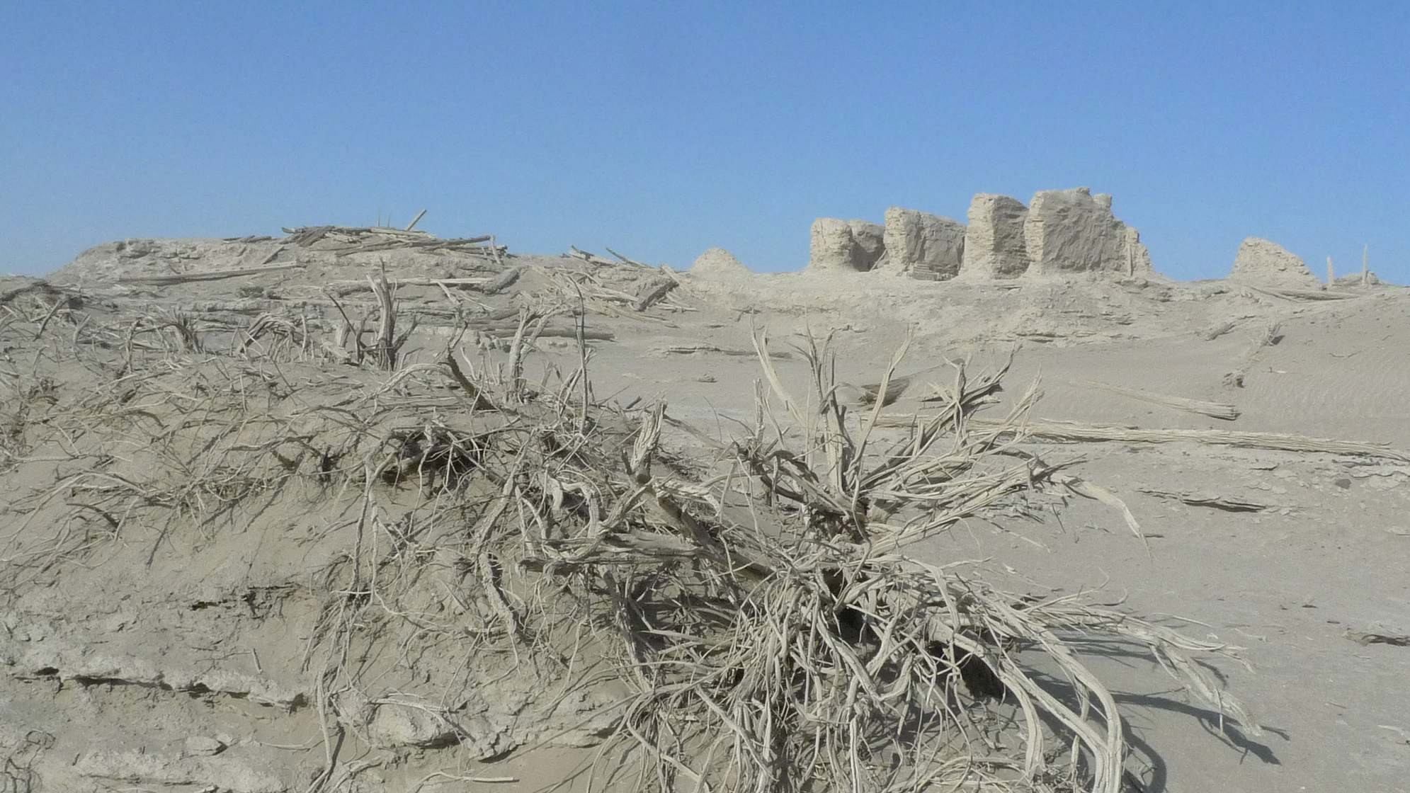
For over a century, the Silk Road -- a term coined in 1877 by German explorer Baron von Richthofen -- has intrigued modern historians and archaeologists who wish to understand the emergence of what many consider the world's most complex ancient overland trade system.
"The locations of ancient cities, towns, shrines and caravan stops have long illustrated key points of interaction along this vast network, but defining its many routes has been far more elusive," Frachetti said. "As a result, there is little known of the detailed pathways used for millennia by merchants, monks and pilgrims to navigate and interact across the highlands of Inner Asia."
Scholars have previously traced Silk Road trade corridors by modeling the shortest "least-cost" paths between major settlements and trade hubs. This connect-the-dots approach makes sense in lowland areas where direct routes across arid plains and open deserts correlate with ease of travel between trade centers. But it's not the way highland pastoralists traditionally move in rugged mountain regions, Frachetti argues.
"The routes of Silk Road interaction were never static, and certainly not in the mountains," Frachetti said. "Caravans traversing Asia were oriented by diverse factors, yet in the mountains their routes likely grew out of historically ingrained pathways of nomads, who were knowledgeable and strategic in mountain mobility."
Though Inner Asia's massive mountains separated oasis societies living in hot, arid lowlands, the region's mountain nomads were united by a shared ecological challenge: hot summers that left lowland pastures parched and barren. In response, mobile pastoralists evolved a similar strategy for success across the entire mountain corridor: escaping the grass-withering summer heat by driving flocks to higher elevations, Frachetti contends.
"Archaeology documents the development of mountain-herding economies in highland Asia as early as 3000 B.C., and we argue that centuries of ecologically strategic mobility on the part of these herders etched the foundational routes and geography of ancient trans-Asian trade networks," Frachetti said.
To test this theory, Frachetti and colleagues designed a model that simulates highland herding mobility as "flows" directed by seasonally available meadows. Although the model is generated without using Silk Road sites in its calculations, the pathways it projects show remarkable geographic overlap with known Silk Road locations compiled independently by Tim Williams, a leading Silk Road scholar at the Institute of Archaeology, University College London.
"The development of the Silk Roads through lowland deserts, fertile piedmonts and oases was influenced by many factors. However, the overlay of pasture-driven routes and known Silk Road sites indicate that the highland Silk Roads networks (750 m to 4,000 m) emerged in relation to long-established seasonal mobility patterns used by nomadic herders in the mountains of Inner Asia" said Williams, a co-author of this study. Williams also is author of the International Council on Monuments and Sites (ICOMOS) thematic study of the Silk Roads, which underpinned the UNESCO World Heritage serial transnational nominations.
Frachetti, who directs the Spatial Analysis, Interpretation, and Exploration (SAIE) laboratory at Washington University, has studied nomadic herding cultures and their ancient trade networks around the world. He has led excavations at sites in Uzbekistan, Kazakhstan and other Central Asian countries.
His field work documents that these societies had inter-continental connections spanning thousands of years, a phenomenon he traces to the antiquity of cross-valley pathways that, once engrained, formed the grassroots network that became the Silk Road.
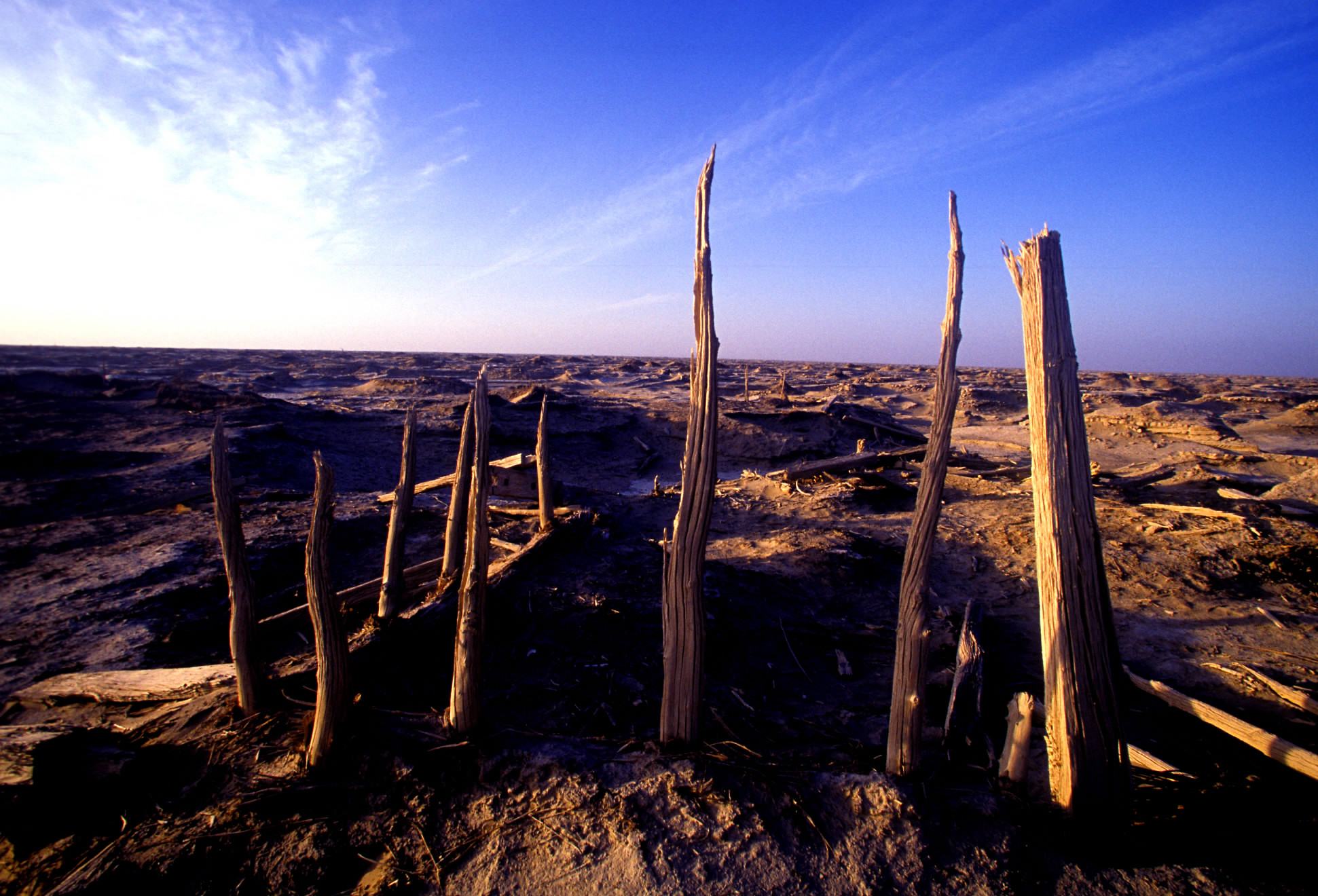
Proving that theory is challenging because the Silk Road's central corridor runs through some of Inner Asia's most remote mountain ranges: the Hindu Kush in Northern Afghanistan; the Pamir in Tajikistan; the Dzhungar in Kazakhstan; the Tian Shan in Kyrgyzstan, Kazakhstan and Xinjiang (China); and the Altai Mountains in Kazakhstan, Russia and Mongolia.
His approach relies on the creative application of GIS and Remote Sensing tools normally used to simulate the flow of streams, rivers and other drainage through watersheds. In hydrological applications, "flow accumulation" relies on the known properties of water being pulled to lower elevations by gravity, generating calculations that show how runoff feeds into a network of ever-larger streams and rivers.
Frachetti swaps gravity for grass and uses the flow accumulation algorithm to calculate how the quality of lush pasture might channel flows of seasonally nomadic herders across a massive, 4,000-kilometer-wide cross-section of Asia's mountainous corridor.
The study area, which spans portions of Iran, India, Russia, Mongolia and China, was divided into a grid of one-kilometer cells, each of which received a numerical rating for grass productivity based on the reflectance of vegetation detected in multi-spectral satellite imagery. GIS software was used to calculate paths highland herders likely followed as pursuit of best-available grazing pulled them toward lowland settlements. The most likely routes were defined as those with the greatest cumulative flow over top pastures.
As Frachetti has found in earlier research, nomads do not wander aimlessly. Pastoralist movement through the mountains is rooted in local knowledge of the landscape and is guided by ecological factors, like the seasonal productivity of grassy meadows. Most confine their migrations to a small regular orbit that is closely repeated from year to year.
His flow model accommodates variation through time in the scale and distribution of prime highland grasslands, but suggests that the broad geography of mountain pasture has not changed drastically over the past several thousand years. Routes oriented for the best grazing would be well known to nomads making similar seasonal migrations over many generations.
Varying the simulated mobility model over 500 iterations (the rough equivalent of 20 generations), well-defined, grass-driven mobility patterns emerged. When the route-building process is shown dynamically, small pasture-based paths appear as rivulets and streams that converge over zones of rich pasture to form rivers of nomadic mobility.
While the study provides broad support for Frachetti's theories about the early evolution of the Silk Road, it also provides a roadmap for future research aimed at uncovering ancient structures of social participation across the mountains of Central Asia.
It also offers lessons, he suggests, about the importance of participation and connectivity in overcoming the great challenges that continue to confront civilizations.
"This model demonstrates that these rugged mountains were not huge barriers that forced regional communities into isolation, but acted as channels for economic and political forms of participation that supported long-standing connections between neighboring communities," Frachetti said. "It illustrates that civilization's greatest accomplishments -- evidenced in the amazing scale of Silk Road connectivity -- often arise organically in environments where connectivity is the norm; isolation here would be a formula for disaster."

Story Source:
Materials provided by Washington University in St. Louis. Original written by Gerry Everding. Note: Content may be edited for style and length.

Journal Reference:
  1. Michael D. Frachetti, C. Evan Smith, Cynthia M. Traub, Tim Williams. Nomadic ecology shaped the highland geography of Asia’s Silk RoadsNature, 2017; 543 (7644): 193 DOI: 10.1038/nature21696